_
Based on satellite imagery analysis of the Nusantara Atlas Monitoring Institute, that area is almost 12 times the area of London, England.
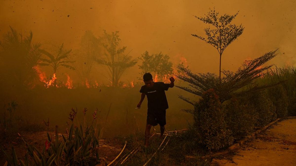
Forest fires and land in Indonesia scorched nearly 1.9 million hectares throughout January to the end of September this year, according to a monitoring agency that analyzes satellite imagery on Monday (19 / 10).
Based on satellite imagery analysis of the Nusantara Atlas Monitoring Institute, that area is almost 12 times the area of London, England.
Founder of Nusantara Atlas, David Gaveau, says that number is a conservative estimate. The area that burned down is actually estimated to be larger because thick smoke fog is blocking monitoring via satellite.
According to Nusantara Atlas's data, the area area burned to 1,916,588 hectares until the end of September. That number increases 38 percent compared to the same period in 2019.
Meanwhile, the Indonesian government has not announced the latest data regarding the area of forest fires and land since it reported 202,000 hectares region burned to the end of July.
Gaveau explained Nusantara Atlas uses conservative counting methods to avoid detection errors. The institution did not include signs of a fire less than 6.25 hectares in computation.
"Our vast estimate of burning land is conservative for two reasons. First, we don't include signs of a fire less than 6.25 hectares... Secondly, we prioritize to avoid false detection," Gaveau said, as the AFP reported.
Besides, thick smoke fog covering a number of areas is blocking satellite surveillance. The conditions make the total area of fires reported lower than the actual conditions.
"Therefore, the total area area was burned down which was reported lower than the area area actually burned down," said Gaveau.
The Nusantara Atlas data also shows that this year's fire was potentially equivalent to a massive fire in 2015.
However, the agency does not have satellite data that can be compared to that period because satellites used are not yet available when the fire occurred.
Nevertheless, Gaveau assesses the situation this year as well as the 2015 fire. It refers to the trend of increasing amounts of heat points or hotspots.
"My intuition says it's probably just as bad. If you look at the amount of hot spots, the trend keeps rising," said Gaveau.
Source: CNN Indonesia ›


Comments (0)
No comments yet.